
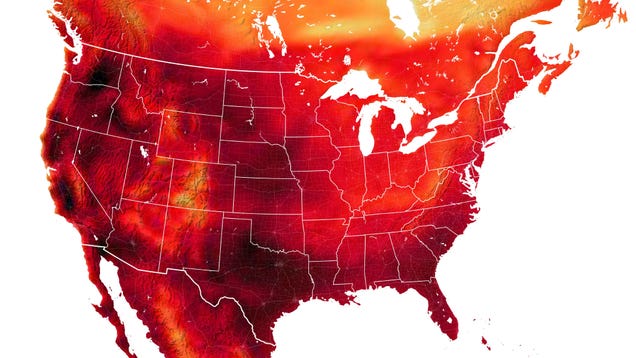
We knew July was sweltering, but this air temperature map based on NASA satellite data really puts it in perspective. The darkest areas represent temperatures around or above 100 degrees Fahrenheit (38 degrees Celsius)—heat that can easily turn deadly for vulnerable people.


