
4 min read
Sols 4289-4290: From Discovery Pinnacle to Kings Canyon and Back Again
Earth planning date: Wednesday, Aug. 28 2024
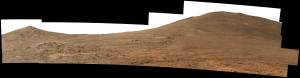
We are back … almost, anyways. Today’s parking location is very close to where we parked on sol 4253, and in an area near one of the previous contact science targets “Discovery Pinnacle.” You can read in this blog post that most of the team, this blogger included, was in Pasadena for our team meeting when we were last in this area. That was July and Curiosity was about to turn 12 on Mars. Coming back is a very rare occasion and is always planned carefully. Once or twice during the last 12 years it happened because we saw something “in the rear mirror.” One of the examples is the target “Old Soaker,” where we spotted mud cracks in the images from a previous parking position, and promptly went back because this was such an important discovery. At other times it was carefully planned, such as the “walkabout” at “Pink Cliffs,” which you can watch in this video from as long back as Earth year 2015. In the past few planning cycles, it’s more of the latter as we made our way from Discovery Pinnacle, where we were on sol 4253, “Just passing through” “Russell Pass” and arriving at “Kings Canyon,” our drill location, which we reached on sol 4257. You can follow all the action of the drilling at Kings Canyon on the blogs. It took a while — it always does — because it’s an activity with many steps and investigations to complete. We actually celebrated Curiosity’s 12th birthday at Kings Canyon! We departed on sol 4283, came back via “Cathedral Peak,” and are now near the Discovery Pinnacle location again. After that little walkabout through the history of (some) of Curiosity’s walkabouts, especially the very last one, let’s look at today’s plan.
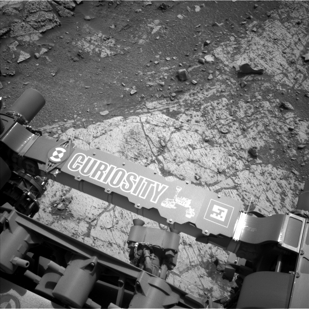
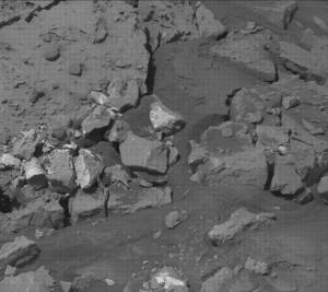
It is a pretty normal two-sol plan, with a one-hour science block before we drive away from this location. We were greeted by a nicely flat surface, and the engineers informed us that we have all six wheels firmly on flat and stable ground. That’s always a relief, because only then can we use the arm. That nice piece of flat rock Curiosity is so firmly parked on became our science target …well, mostly. Some of the little pebbles on the surface attracted our attention, too. The very eagle-eyed can spot a small white spot in the image above. It’s right between the arm and the rover itself, about where the C is written. That’s a rock that we likely broke up with our wheel and that has a very white part to it. We called it “Thousand Island Lake,” and will image it with MAHLI. APXS is investigating a target called “Eichorn Pinnacle,” squarely on the big flat area. LIBS is also making the most of the large target underneath and in front of us, investigating the target “Nine Lakes Basin.”
In recent blogs you will have read about the dust-storm watch making the atmospheric investigations even more important, so we don’t miss any changes. We are looking for dust devils, atmospheric opacity, and are of course monitoring the weather throughout the plan.
Our drive will hopefully — if Mars agrees — be a long one, and we will also plan an activity that we call MARDI sidewalk. That’s when we take very frequent pictures with the MARDI instrument while driving. This results in a long strip of images nicely showing the nature of the terrain the rover has driven over. This is in addition to the MARDI single frame we are taking every time the rover stops. I often get the question, why are we taking an image just downwards whenever the rover stops? Well, humans are easy to bias toward the outliers, toward the things that look special, and of course the Curiosity team is no exception. For some things this is great, because it allows for the discoveries of new things. But it doesn’t provide an unbiased overview. That’s what MARDI does: It always points down and reliably records the terrain under the rover. We don’t have to do anything but put the commands for that one image into our plan after the drive — something that’s pretty routine after 12 years now!
Written by Susanne Schwenzer, Planetary Geologist at The Open University


